São Vicente (Abrantes (São Vicente))
São Vicente is a former freguesia ("civil parish"), located in the municipality of Abrantes, in Santarém District, Portugal. In 2013, the parish merged into the new parish Abrantes (São Vicente e São João) e Alferrarede. The population in 2011 was 11,622, in an area of 38.20 km². It included the northern part of the city of Abrantes.
A parish of São Vicente is the principal religious organ of the community of Abrantes, and its foundation dates back to the Goths. The ancient church of São Vicente was founded in 1149, after Afonso Henriques took Abrantes Castle, but it subsequently received damage from Moorish attacks and was rebuilt.
It was known until 1150, as the parish of Nossa Senhora da Conceição and reconsecrated by the first alcaide from permission obtained from Afonso Henriques (a reliquary of São Vicente Mártir was installed in the church). The church was reconstructed under the initiative of King Sebastião, a project that concluded in 1590 under Philip I, completed and elaborated in the mannerist style.
It became a priory and vicarage of the Royal Prior, Father Carvalho e Avelino de Almeida, but by 1758 these institutions (including many of the religious parishes, paróquias, of Abrantes, such as São Pedro and Santa Maria do Castelo) were under the protection of the Marquis of Abrantes. Parish records for 1862 refer to São Vicente being passed on to the Marquis of Abrantes by the Order of Christ. The vicar of São Vicente represented the clergy of São Pedro de Alvega, São Silvestre de Aboboreira, Santa Eufémia de Rio de Moinhos and Santa Luzia do Pego, alternately with the parish of São João Baptista which was the seat of the adjunct, treasury and administration of the diocese.
The parish administration of São Vicente was merged with that of Santa Maria do Castelo around 1834, although records for the latter continued until 1774.
Today, the religious parish is part of the diocese of Portalegre-Castelo Branco.
Map - São Vicente (Abrantes (São Vicente))
Map
Country - Portugal
 |
 |
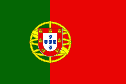
| Flag of Portugal | |
One of the oldest countries in Europe, its territory has been continuously settled, invaded and fought over since prehistoric times. The territory was first inhabited by pre-Roman and Celtic peoples who had contact with Phoenicians, ancient Greeks and Carthaginians. It was later ruled by the Romans, followed by the invasions of Germanic peoples and the Islamic invasion by the Moors, whose rule was eventually expelled during the Reconquista. Founded first as a county of the Kingdom of León in 868, gained its independence as the Kingdom of Portugal with the Treaty of Zamora in 1143.
Currency / Language
| ISO | Currency | Symbol | Significant figures |
|---|---|---|---|
| EUR | Euro | € | 2 |
| ISO | Language |
|---|---|
| PT | Portuguese language |


